If you want to design a plot of land in 2D and 3D yourself, you don’t need to hire an expensive professional. With modern software like Plan7Architect, you can create a precise land plan, define property boundaries, and visualize everything in 3D. The software supports both European (meters) and American (feet) measurement units, so you can work with the system that suits your needs.
The 2D mode is ideal for technical layouts, measurements, and zoning compliance, while 3D visualization helps with realistic representations of slopes, elevations, and landscaping features. Whether you are planning a new home, garden, or driveway, the process is straightforward with the right tools.
Why Create a Plot Plan Yourself?
Creating a land plan yourself has several advantages, especially if you use professional software that simplifies the process.
Key Benefits of DIY Plot Planning
- Cost Savings – Avoid expensive professional fees.
- Full Control – Customize the plan according to your vision.
- Better Decision-Making – Helps with buying land, zoning approval, and landscaping.
- 3D Visualization – See how everything fits before construction starts.
Common Use Cases
| Use Case | Why It’s Important |
|---|---|
| House Construction | Ensure proper placement of buildings. |
| Garden & Landscaping | Plan paths, trees, and fences in detail. |
| Property Expansion | Visualize garages, sheds, and additional structures. |
| Legal Documentation | Prepare accurate plans for zoning authorities. |
Choosing the Right Software – Why Plan7Architect?
Not all plot planning programs offer the same level of detail and ease of use. Plan7Architect is a top choice for both beginners and professionals because it provides a combination of precision, usability, and realistic 3D modeling.
Key Features of Plan7Architect
- Supports both 2D & 3D planning for complete control.
- User-friendly interface with drag-and-drop functionality.
- Predefined templates for quick setup.
- Precise measurement tools for meters and feet.
- Import/export options for CAD files and GIS data.
- Realistic terrain modeling to adjust slopes and heights.
Tip: Plan7Architect allows you to switch between metric and imperial units at any time, so you can work with the system you are most comfortable with.
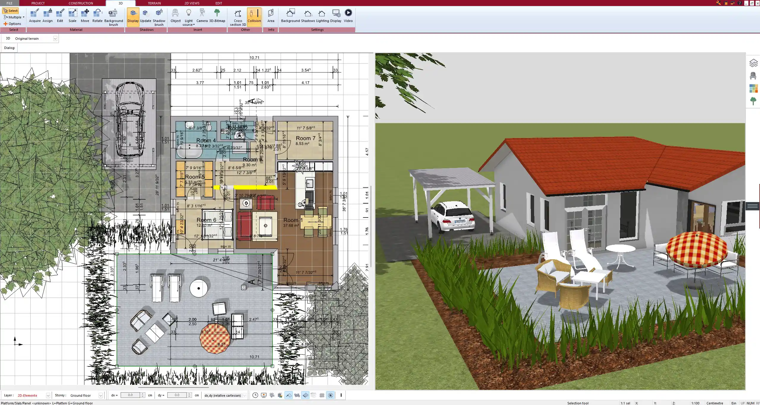
Step-by-Step Guide to Planning a Plot in 2D & 3D
Setting Up the Basic Layout
- Define property boundaries based on official land survey data.
- Choose the measurement unit (meters or feet) depending on your preference.
- Import satellite images or survey maps to ensure accuracy.
- Set terrain elevation if the plot is on a slope.
Adding Essential Elements
A well-planned plot includes not only buildings but also landscape elements and infrastructure.
- Buildings and Structures – House, garage, sheds, guest house.
- Access Points – Driveways, pathways, gates.
- Natural Elements – Trees, garden zones, water features.
- Fences and Walls – Define boundaries and privacy zones.
Refining the Details
Once the basic layout is complete, it’s time to fine-tune the details for accuracy.
- Adjust terrain elevations to reflect real-world conditions.
- Place utilities such as water, electricity, and drainage points.
- Organize elements into layers for better visualization.
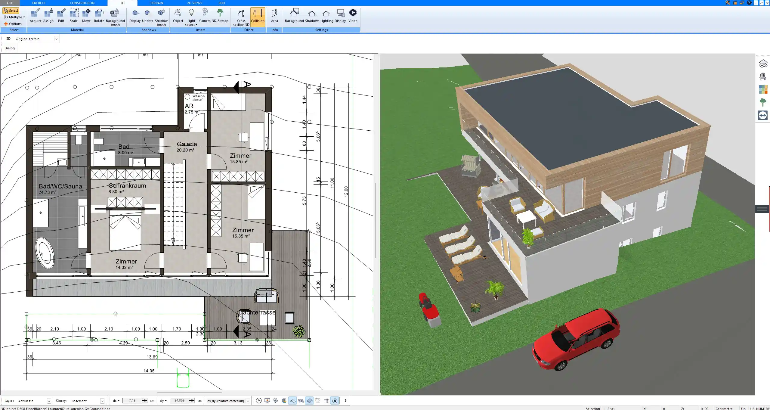
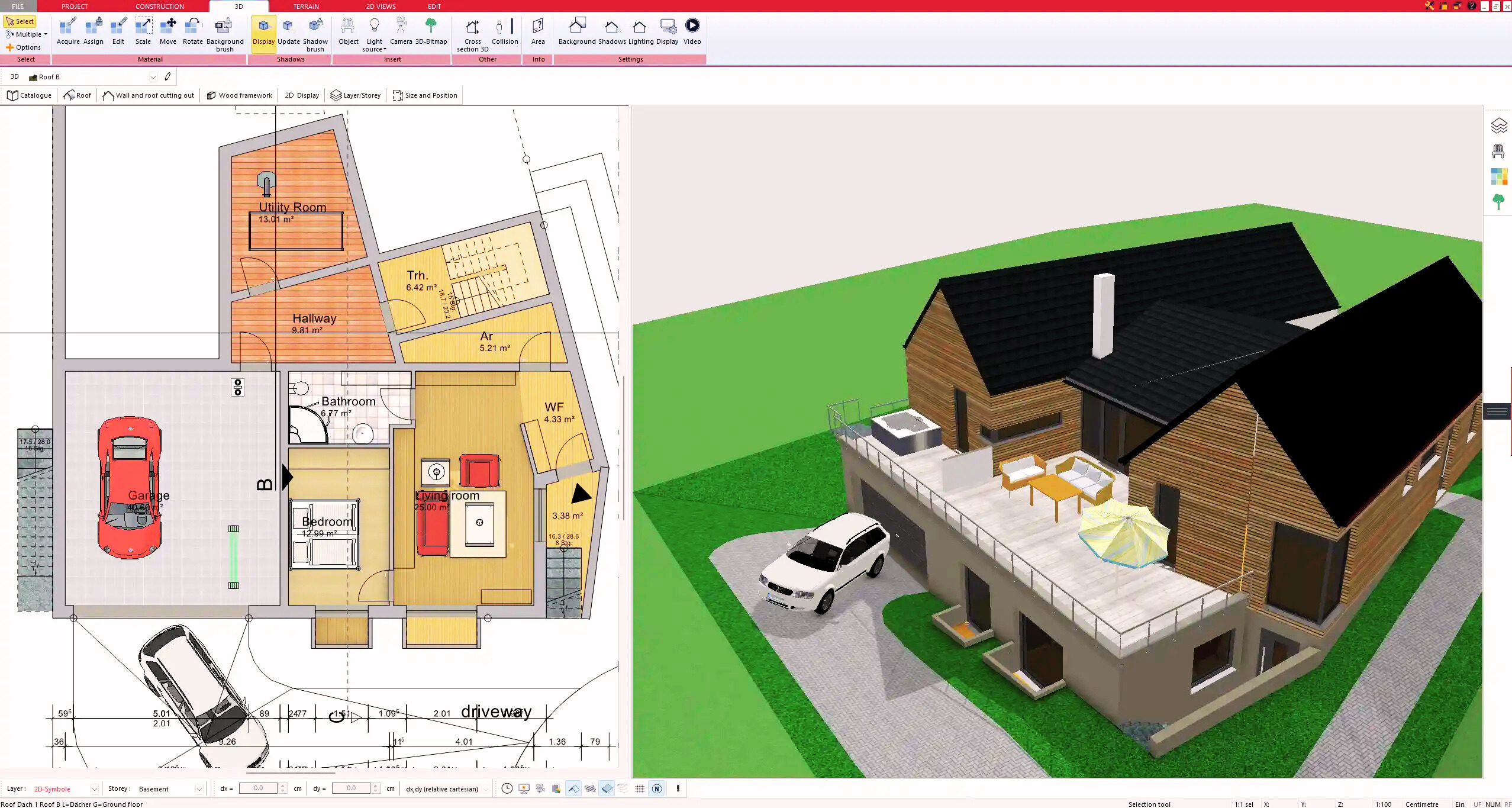
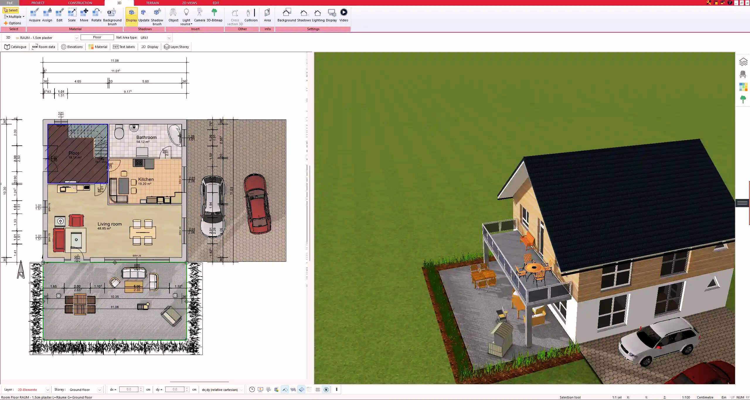
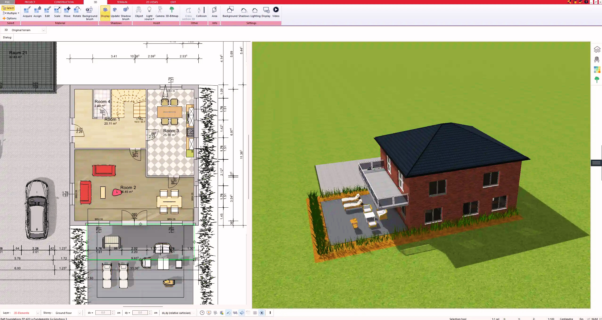
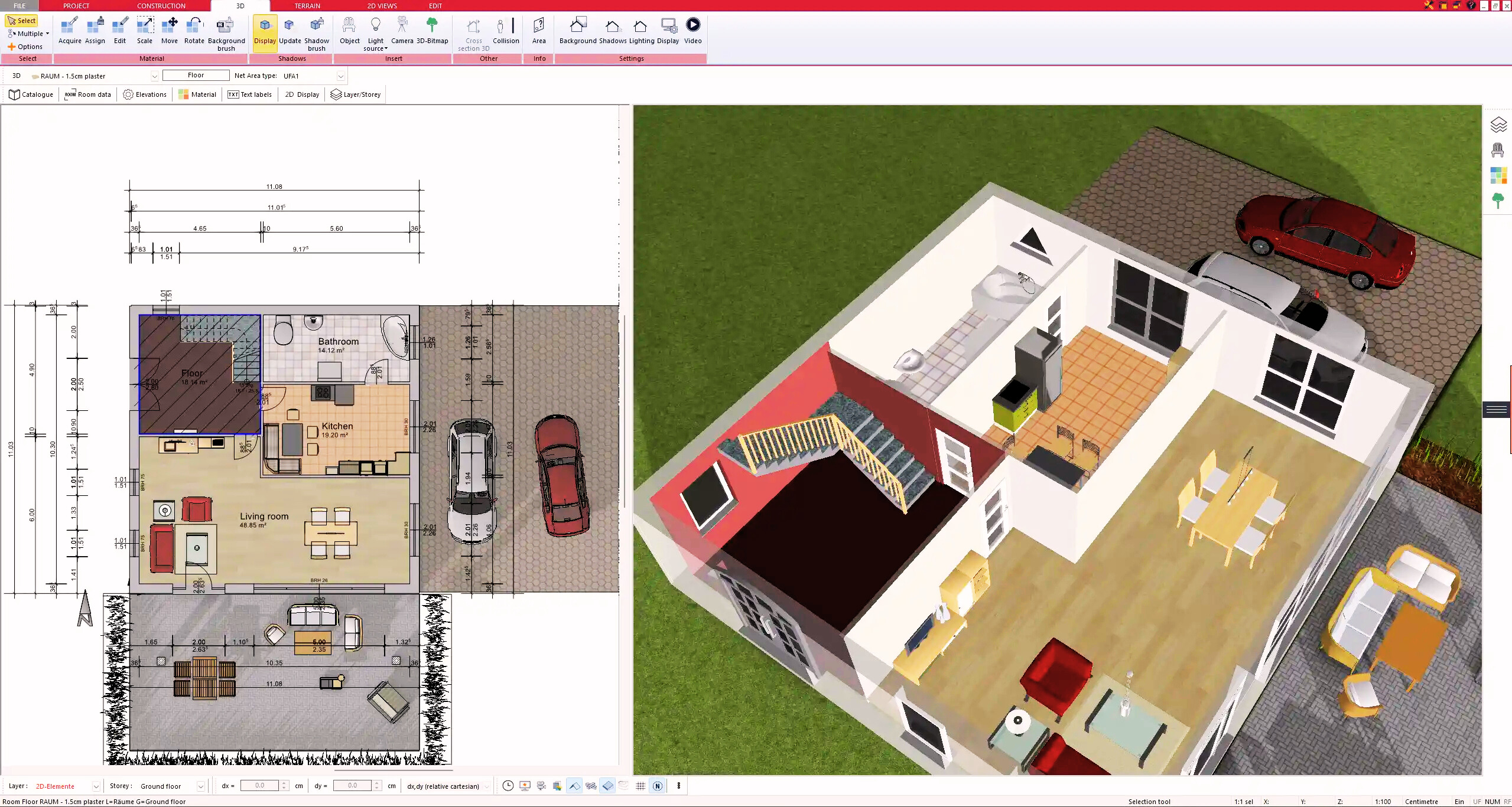
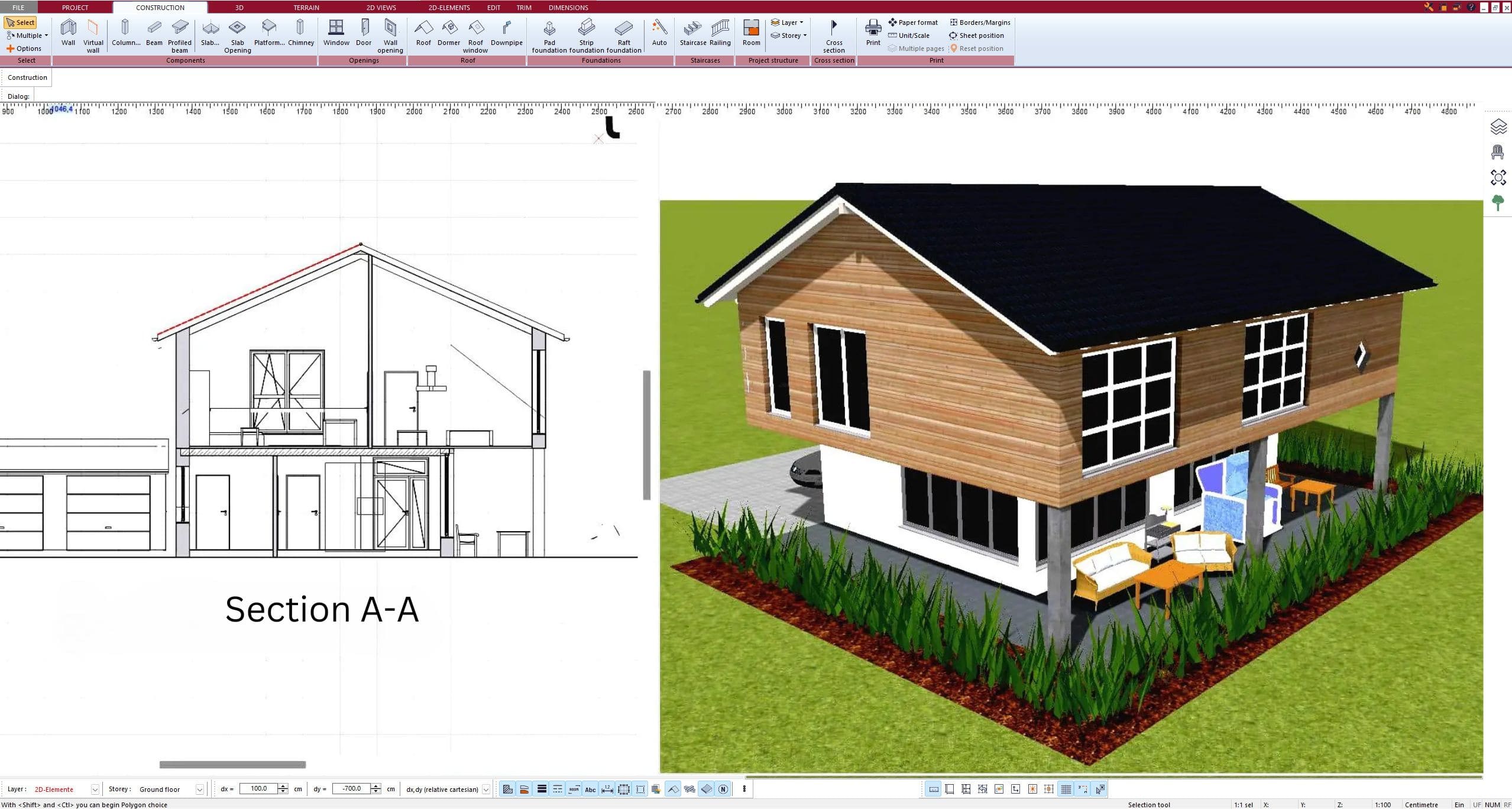
Switching Between 2D & 3D Views
One of the biggest advantages of using Plan7Architect is the ability to seamlessly switch between 2D and 3D views.
- 2D mode: Provides a technical overview, ideal for blueprinting and measurements.
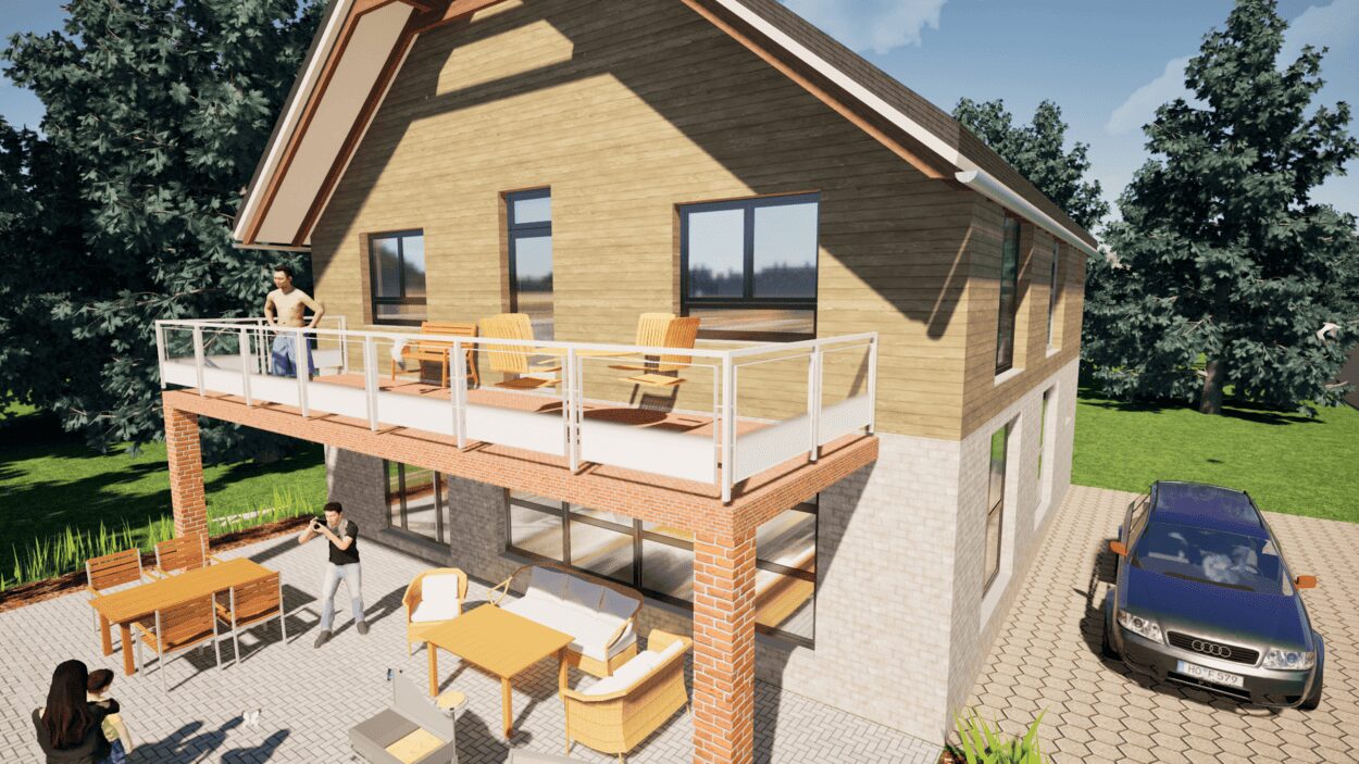
- 3D mode: Allows for realistic visualization, making it easier to understand the layout.
Tip: Use the 3D mode to check how shadows and sunlight will affect your property throughout the day.
Exporting and Printing Your Plan
Once the plot plan is finalized, you might need to export or print it for documentation or construction.
| Format | Use Case |
|---|---|
| Easy to share with builders or zoning authorities. | |
| CAD File | Compatible with professional architecture software. |
| Image (JPG, PNG) | Quick visual references for personal use. |
Common Challenges & How to Overcome Them
Ensuring Accurate Measurements
- Always use official survey data to define property boundaries.
- When in doubt, import GIS data for higher precision.
Dealing with Complex Terrain
- Adjust elevation levels manually in the software.
- Use terrain modeling tools to reflect real-world slopes.
Understanding Zoning Regulations
- Check local building codes to avoid legal issues.
- Use the software’s layering feature to separate zones for compliance.
Conclusion – The Best Software for Plot Planning
If you want to plan a plot of land in 2D and 3D professionally while keeping full control over the process, Plan7Architect is the ideal software. It allows you to visualize your ideas, refine measurements, and create accurate documentation for any property type. Whether you’re designing a residential home, a garden, or an expansion project, the intuitive interface and precise measurement tools make planning easy and efficient.
With support for both meters and feet, realistic 3D terrain modeling, and export options for professional use, Plan7Architect is the best choice for private landowners and professionals alike. Start designing your plot today and bring your vision to life with ease.
Plan your project with Plan7Architect
Plan7Architect Pro 5 for $99.99
You don’t need any prior experience because the software has been specifically designed for beginners. The planning process is carried out in 5 simple steps:
1. Draw Walls
2. Windows & Doors
3. Floors & Roof
4. Textures & 3D Objects
5. Plan for the Building Permit
6. Export the Floor Plan as a 3D Model for Twinmotion
- – Compliant with international construction standards
- – Usable on 3 PCs simultaneously
- – Option for consultation with an architect
- – Comprehensive user manual
- – Regular updates
- – Video tutorials
- – Millions of 3D objects available