Yes, you can create a professional 3D/2D site plan yourself using Plan7Architect. Whether you are planning a residential property, a commercial site, or a large development, this software allows you to design precise layouts with terrain modeling, zoning details, and structural placement. The best part is that you don’t need to be an architect—Plan7Architect provides all the tools to create a professional site plan with ease.
The software supports both metric (meters) and imperial (feet) units, allowing you to choose the measurement system that suits your needs. This makes it suitable for users worldwide, whether you are working with European or American standards.
Plan7Architect is ideal for:
- Private users planning a home or landscaping project
- Professionals creating site plans for construction or real estate
- Developers working on detailed urban or suburban layouts
- Contractors and engineers needing precise zoning and topographical planning
Why Use Plan7Architect for Site Planning?
Intuitive and Professional Interface
Plan7Architect combines ease of use with powerful features, making it ideal for both beginners and professionals. The software has a drag-and-drop interface, allowing you to quickly place buildings, roads, green areas, and other elements onto your site plan.
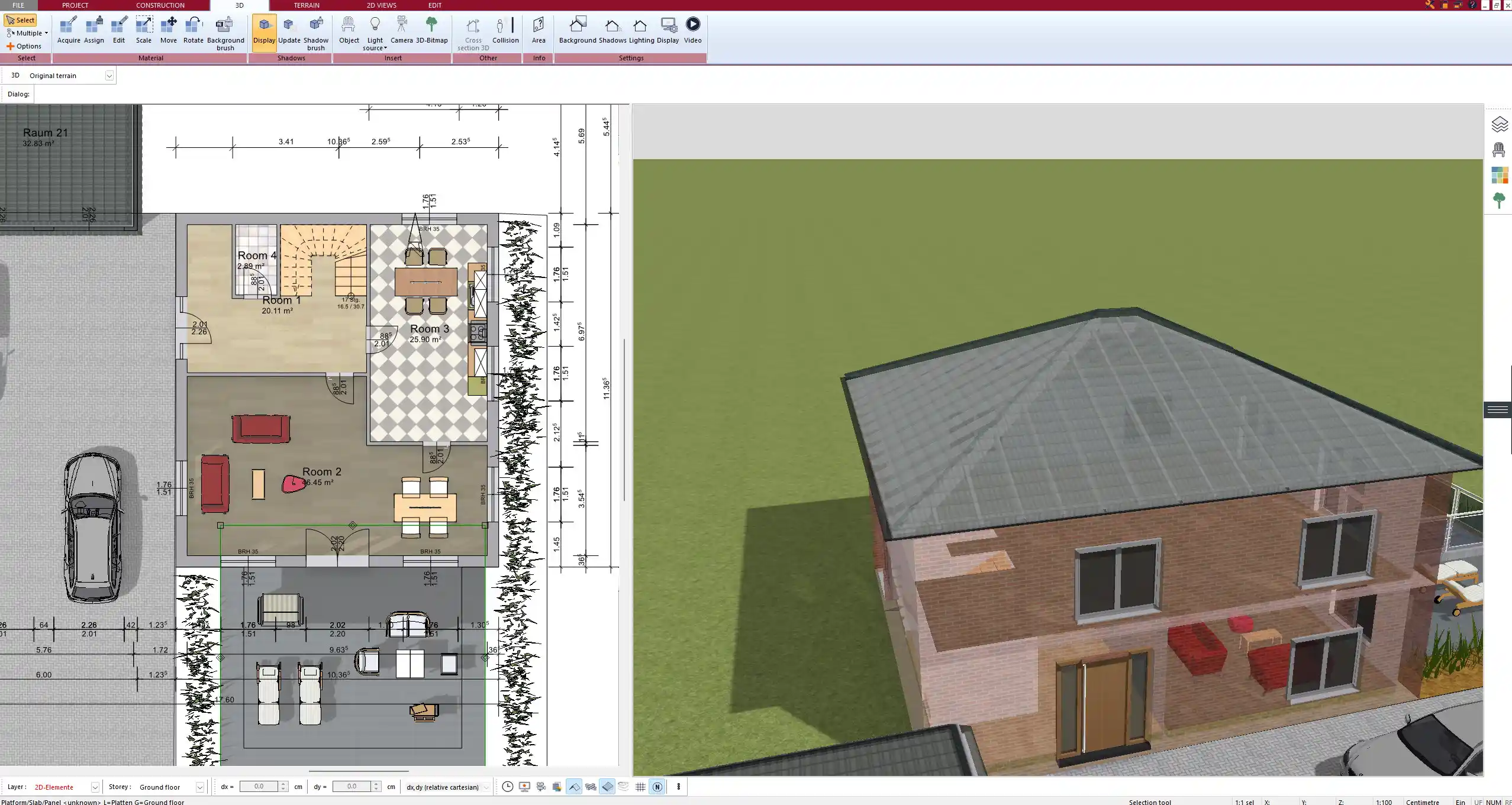
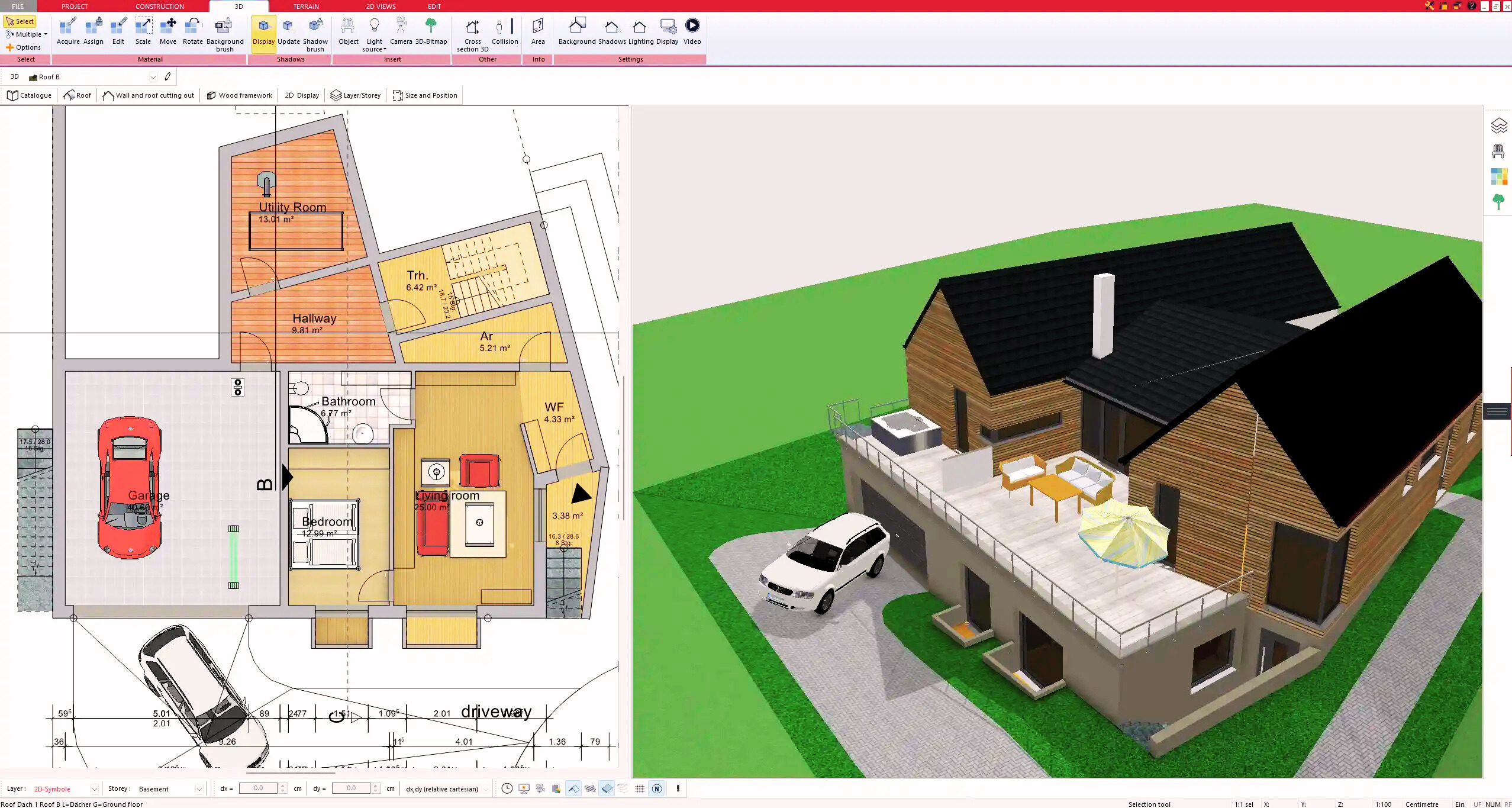
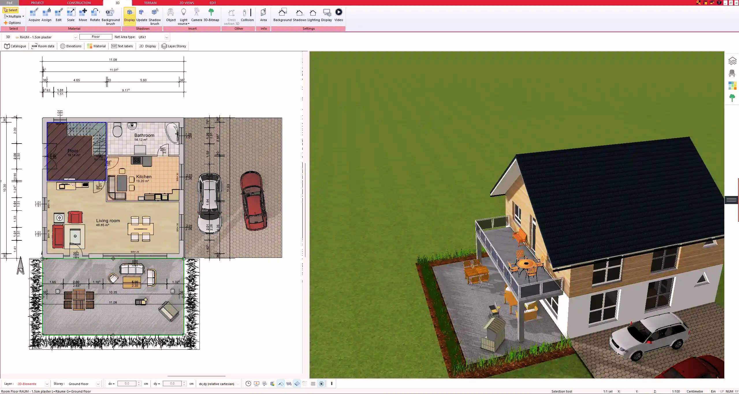
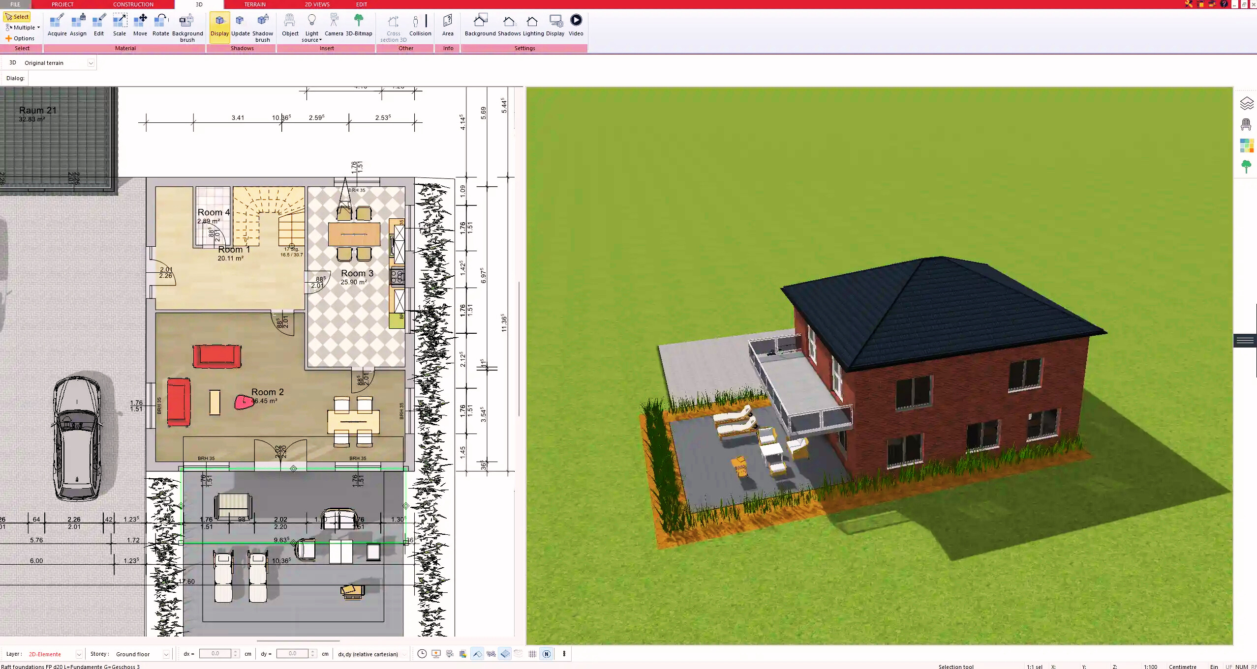
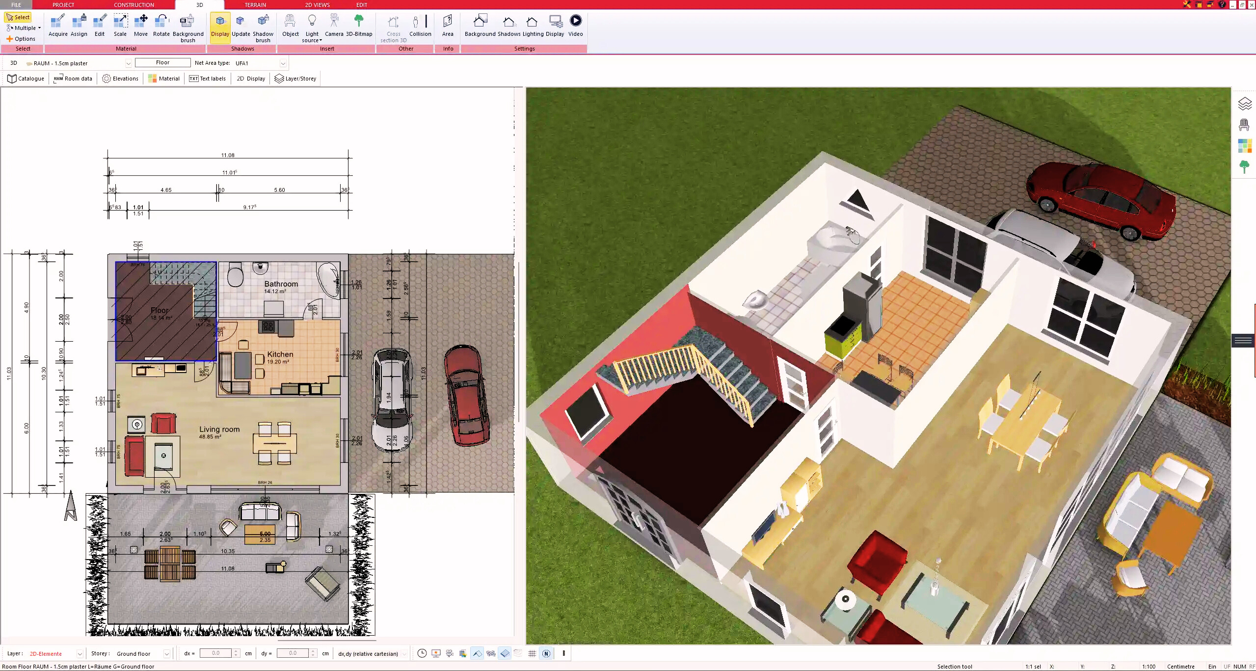
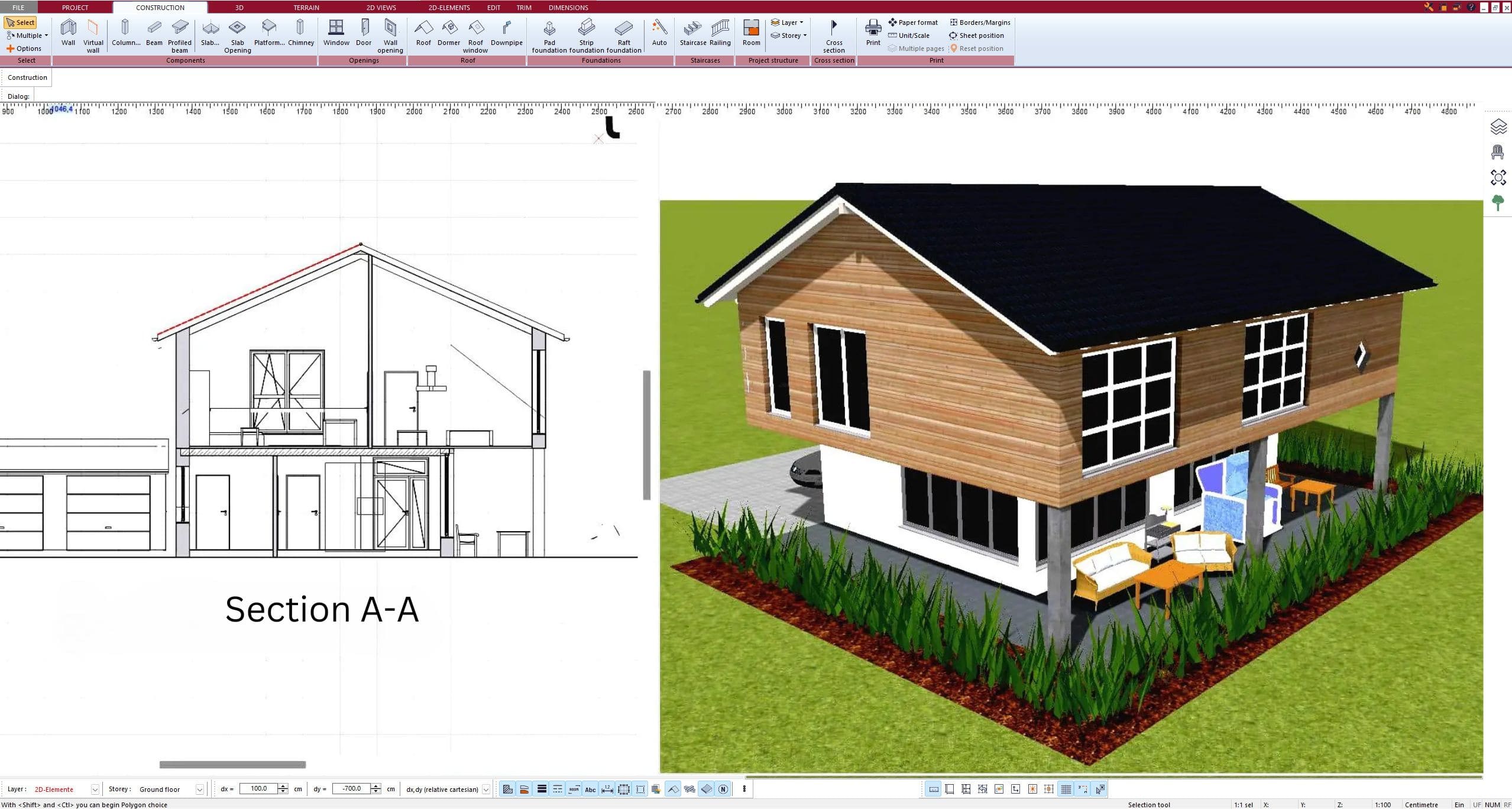
Full 3D Visualization
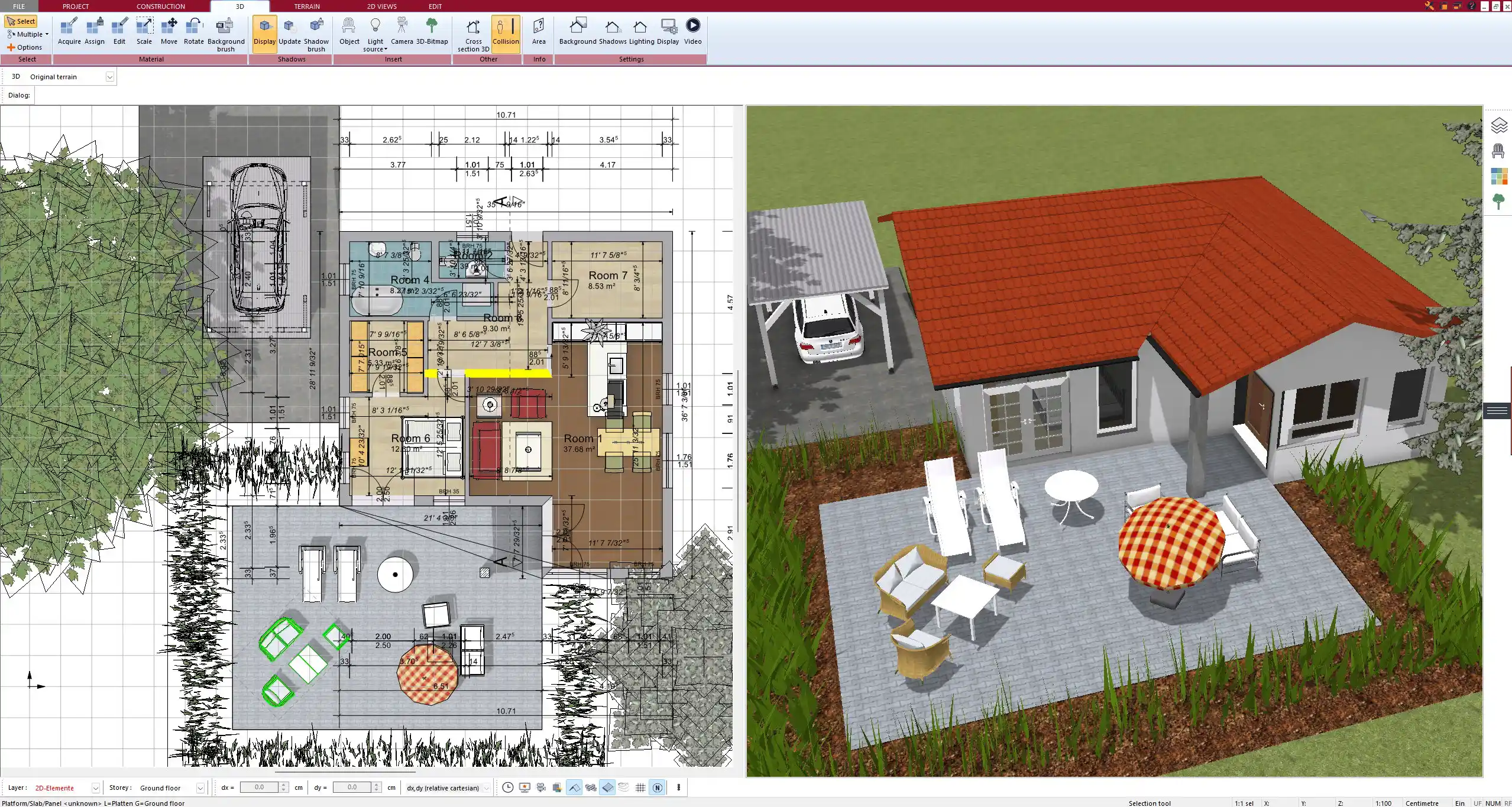
One of the biggest advantages is the ability to switch between 2D and 3D views. You can create your layout in 2D for precise measurements and technical details, then instantly switch to 3D to see how your site will look in real life.
Terrain and Elevation Modeling
Plan7Architect includes terrain tools that allow you to adjust elevation levels, slopes, and contours. Whether you are working with a flat lot or a site with hills, the software ensures accurate representation of land features.
Import and Export Compatibility
The software supports various file formats to import existing site plans or export your designs for further editing in other programs. It works seamlessly with formats such as:
- DXF/DWG (AutoCAD compatibility)
- PDF and image formats for presentations
- 3D rendering formats for visualizations
Multi-Layered Planning
A professional site plan often includes more than just the buildings. With Plan7Architect, you can add:
- Roads, driveways, and sidewalks
- Fencing, property lines, and boundaries
- Vegetation, trees, and landscaping elements
- Utilities such as water, electricity, and drainage lines
Step-by-Step: Creating a Professional 2D Site Plan
Setting Up the Project
To begin, open Plan7Architect and create a new project. The first step is to choose your measurement system (metric or imperial), depending on the standards you are working with.
You can import an aerial image, blueprint, or hand-drawn sketch as a reference. This helps when working on an existing site where you need to overlay buildings and roads onto a real-world location.
After setting the scale and orientation, define the site boundaries and zoning regulations to ensure compliance with local laws.
Adding Key Elements
Buildings and Structures
- Draw foundations, walls, and roof outlines
- Ensure proper placement within lot boundaries
- Consider setback requirements and height limitations
Property Lines and Setbacks
- Clearly mark lot boundaries
- Define legal setback distances from property lines
Driveways, Pathways, and Roads
- Plan vehicle access and parking spaces
- Add sidewalks and pedestrian walkways
Landscaping and Green Areas
- Place trees, gardens, and recreational zones
- Integrate water features, pools, and patios
Utility Connections
- Mark electricity, water, and sewer lines
- Ensure drainage systems are correctly positioned
Fine-Tuning and Annotations
A professional site plan needs clear labels and details. In Plan7Architect, you can:
- Add dimensions to indicate distances between structures
- Use legend boxes to explain symbols and colors
- Apply color coding to distinguish different site areas
Recommended Color Coding for Site Plans
| Element | Recommended Color |
|---|---|
| Buildings | Light Gray / Blue |
| Roads | Black / Dark Gray |
| Green Spaces | Green |
| Water Areas | Blue |
| Utility Lines | Red / Orange |
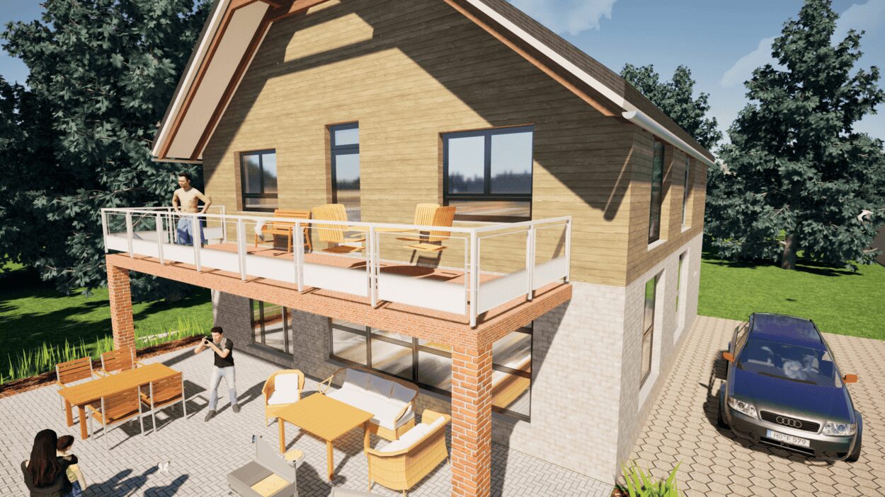
Converting to a 3D Site Plan
Once your 2D layout is complete, you can switch to 3D mode with a single click. This allows you to:
- View the entire site from different angles
- Adjust lighting, materials, and textures for realism
- Check how elevation changes affect the site
In 3D mode, you can also create animated walkthroughs to present your project to clients or stakeholders.
Exporting & Sharing Your Site Plan
Once your plan is finalized, you can export it in multiple formats. Plan7Architect allows you to save your project as:
- PDF for easy printing
- DXF or DWG for further editing in CAD software
- Image files (JPEG, PNG, TIFF) for presentations
If you need to share your design, you can also generate a 3D rendering and export it as a high-resolution image.
Best Practices & Tips for a Precise Site Plan
- Always check zoning laws and building codes before finalizing your design.
- Use layers to separate different elements (e.g., roads, buildings, landscape).
- Test different perspectives in 3D to spot potential design issues.
- Save multiple versions of your project in case revisions are needed.
Tip:
If you are unsure about the correct measurements, Plan7Architect allows you to toggle between metric and imperial units at any time. This makes it easy to work with international clients or adjust designs for different regions.
Conclusion – Why Plan7Architect is the Best Choice
Plan7Architect is the perfect tool for anyone looking to create a professional 3D/2D site plan without hiring an architect. It combines ease of use with advanced features, making it ideal for both private users and professionals.
With tools for precise measurements, terrain modeling, and full 3D visualization, you can ensure that your site plan is accurate and visually realistic. The software also allows for exporting in multiple formats, making it easy to share your project with architects, builders, or clients.
Whether you are planning a private home, a commercial property, or a large development, Plan7Architect offers the flexibility and precision needed to turn your vision into reality. Start designing your site plan today!
Plan your project with Plan7Architect
Plan7Architect Pro 5 for $99.99
You don’t need any prior experience because the software has been specifically designed for beginners. The planning process is carried out in 5 simple steps:
1. Draw Walls
2. Windows & Doors
3. Floors & Roof
4. Textures & 3D Objects
5. Plan for the Building Permit
6. Export the Floor Plan as a 3D Model for Twinmotion
- – Compliant with international construction standards
- – Usable on 3 PCs simultaneously
- – Option for consultation with an architect
- – Comprehensive user manual
- – Regular updates
- – Video tutorials
- – Millions of 3D objects available